Want a taste of what it is like to cruise Alaska but only have a couple of weeks? Check out Vancouver Island’s west coast. This rugged coastline features the natural beauty, desolation and abundant wildlife of the southeast coast of our most northern state giving you a sense of isolation that Alaska is known for. The best part? It’s virtually in our backyard—just 2-3 days from Seattle or Vancouver.
When boaters talk about Vancouver Island it is usually in reference to the inside passage and destinations such as Desolation Sound, Campbell River, Nanaimo, Ladysmith, and other popular stop-overs. While these protected waters and popular ports are worth exploring, it comes with all the features that population centers provide: crowds, stores, marinas, cruise ships, and the other entrapments of what many boaters want to leave on shore. For an escape with new challenges head to the West Coast.
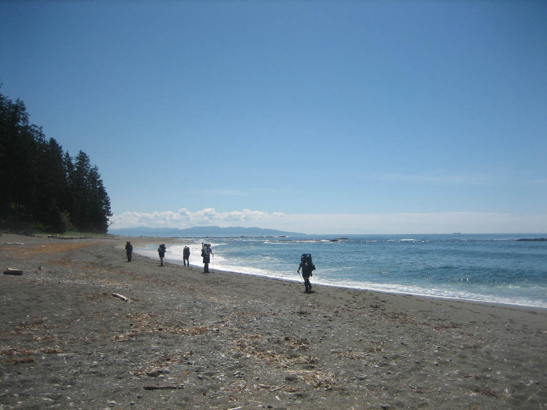
The West Coast or Outer Reaches of Vancouver Island is a nice contrast to the inside passage; its quiet desolation, rugged shoreline, wildlife, and a sense of isolation tseem worlds away. The rocky coastline, often referred to as the Wild West, lacks the blaring lights and countless docks and provides a new frontier for boaters wanting a healthy dose of the unknown.
Boaters will be able to experience the unfiltered strength of the Pacific, but easily duck into a safe moorage when it gets too rough. This is an ideal shake-down cruise to familiarize yourself with a new boat or to build offshore skills with the safety-net of protected coves and inlets.
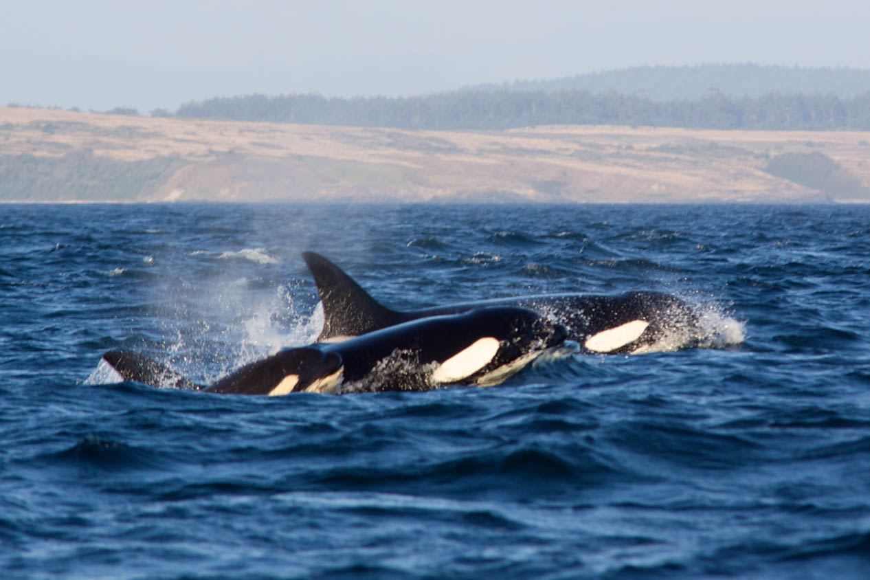
The West Coast features 5 sounds conveniently spaced along the coast that offer seemingly endless anchorage possibilities. These protected inlets are great places to rest for the night and take in some of Vancouver Island’s undisturbed natural beauty. From the deck you will be able to spy bears foraging the shoreline for a meal or bald eagles soaring above the tall conifers. With a dinghy there are opportunities to explore tide pools, hike along the shore or venture up one of the many rivers.
Fishing opportunities are abundant. An accomplished angler can count on a fresh catch for the evening’s dinner. For those boaters new to fishing, there are many guide services in the small towns and ports that provide a great day on the water.
When you need a dose of civilization or to restock before exploring a deep inlet, there are ports and small towns scattered along the coast—some only accessible by water. Each town is unique and provides a different spin on life on the West Coast. Check local event information to plan your trip to coincide with a music festival, art festival, and other regional events.
The most common complaint about Vancouver’s West Coast or Outer Reaches is the overwhelming abundance of opportunities for exploration. Halfway through the trip, boaters are typically planning their next trip and they return to their homeport with a dog-eared guidebook and a chartplotter loaded with waypoints to visit the following season.
Go Prepared
While the West Coast of Vancouver Island isn’t Alaska, it offers some of the same challenges to boaters. There are some details and local knowledge that should be taken into consideration to make your journey safe: and more importantly fun.
The West Coast is isolated; repair facilities and chandleries are few and far between. You will need to be self-sufficient to a higher degree than traveling the inside passage. Have a good understanding for your boats systems. The ability to perform basic repairs will minimize any downtime and maximize the enjoyment of the trip and keep your boat and crew safe.
Before exploring the West Coast of Vancouver, give your boat a thorough spring commissioning effort tackling everything on your to-do list. It is a good idea to secure items in shared lockers to prevent damage if you experience rougher conditions. Have spares aboard to tackle fuel system clogs and cooling water system emergencies. With the rougher seas, fuel system clogs are common as debris is loosened up by fuel sloshing around the tanks, have a spare fuel filter and know how to quickly change it. Dual filter systems are the best approach and can get you out of a jam faster.
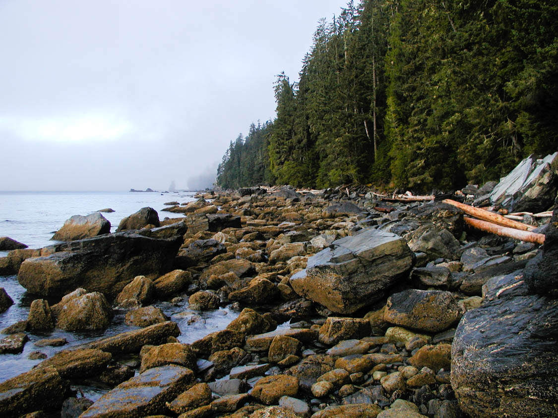
The rocky shoreline poses unique hazards to enjoying this isolated area. Updating your charts and carrying paper charts are great ideas, but as you approach the shore your eyes will tell you much more. The tidal changes will put some of the rocks dangerously below the surface. Look for whitewater, spray and current swirls as a warning to hull-damaging threats. Modern, forward-looking sonar can take some of the stress out of entering unfamiliar waters, but ultimately your eyes are the best tool.
Wind will be a factor. For this reason, sailors typically approach the West Coast from the north to have a following wind and following seas; and normally travel during the afternoons when the wind is up. Just the opposite is true for power-boaters. The calm mornings make for smoother passage and an approach from the south puts the bow to weather.
Locals refer to August as “Fogust”. The mornings are usually blanketed in fog, but it normally burns off by the afternoon. If you plan to travel in the mornings (power-boaters) it is a good idea to have a functioning radar system and radar reflectors. At the very least an AIS system that may warn surrounding traffic of your presence and alert you to nearby vessels.
Depending on your insurance carrier, you may need to get a rider for the trip. Check with your agent to know what is exactly needed to be covered for the trip.
Ports/Provisions
Despite all of the discussion of its remoteness and isolation, there are several ports to re-supply and re-group. The larger ports typically provide fuel, grocery stores, dining, and repair facilities. Many offer WiFi to reconnect with the outside world—if you wish. It is important to note that 50 amp shore power service is not available at smaller marinas; it is a good idea to have the ability to operate on 20 amp or 30 amp service and be prepared to modify power use to match available service.
Below is a list of popular ports to dine, re-stock, re-fuel and explore arranged from Victoria to Port Hardy (south to north). There are loads of other small towns and hamlets worth visiting along the West Coast some may have limited services.
- SookePort
- Renfrew
- Bamfield
- Ucluelet
- Tofino
- Kyuquot (Walters Cove)
- Port Alice (located deep in the Quatsino Sound)
- Winter Harbour
- Port Hardy
Local Knowledge
- Take time to plan your route to include stops to re-supply and carry extra provisions in the event you have to wait-out fog, storms, or rough seas. Use the resource section below to get the most out of your trip.
- Take along a guidebook: There are several guidebooks available (listed in Resources section) that are updated on a regular basis and will provide valuable information. Updated marina maps with phone numbers are included with information on dining, sightseeing and repair facilities. Local events will be listed and will provide a more intimate experience with the local culture. There are even descriptions of holding properties of the bottom.
- Bring Spares: Repair facilities and marinas can be far away. Some of the towns are only accessible by water—next-day delivery is not an option in many locations. Take along common spares (fuel filters, impellers, anodes, etc.) and know how to handle the un-expected clog or emergency. This is especially important if your boat has unique equipment that has made it difficult to find parts in your home port.
- Which Direction?:
- Powerboaters generally prefer a clockwise circumnavigation of Vancouver Island to keep the weather at the bow. Power boaters can take advantage of calm winds and seas by traveling in the morning.
- Sailors prefer a counterclockwise circumnavigation to have the wind and seas to the stern. And typically travel in the afternoon will provide wind and the fog is likely to have burned off.
- Hazards: The rocky coast is no joke. Snags and fiberglass eating rocks loom just below the surface. Consult the tide charts and keep a watchful eye on the surface to spot whitewater, spray, and swirling water caused by tidal currents or any other indicators of shallow water.
- Weather: The summer months run the full gammet: wind, rain, and fog
- Southerly gales are short lived—just a day or two.
- Northerly gales can last a week. Cheleset Bay southeast of Brooks Peninsula can provide excellent exploring opportunities when the winds are up
- “Fogust” (August) can make navigation difficult, but it usually burns off in the afternoon
- Dinghy: Exploring the splendor of remote shoreline areas is best done with a rugged inflatable dinghy; it is also an excellent tool to inspect unfamiliar moorages before anchoring for the night. Having an engine strong enough to get the boat in plane is ideal. Bring a long a patch kit and pump to take care any unforeseen issues.
- Next Trip: Keep notes for the next season—there are too many intriguing coves, bays and other anchorages to explore in a single trip. Mark paper charts and set waypoints on the chartplotter for following seasons. A journal is also helpful.